Great news for anyone in Norway who wants to stay ahead of potential flood risks—Intoto, a leading water risk management company based in Norway, has just launched Flomsoner.no (which translates to “Flood Zones”). And the best part? It is completely open for the public to use. This is Intoto’s way of giving back to the communities of Norway.
Norway has nearly 200 areas defined as flood risks. Traditional tools are rarely used because they’re overly complicated, even though the information results from costly and complex studies. Intoto’s goal with Flomsoner.no is to make complex things simple – to bring static information to life by connecting it to their live data, and by making it simple and easy for the public to use.
Frode Aagedal, co-founder of Intoto says, “I’ve heard the frustrations from many municipalities on complicated flood zones in many meetings. And those who should care do not even understand the problem, so we decided to spend literally a couple of hours to make something better than everything that exists out there. So we did. It is ready for the public to use. And we’ll use it to learn, get feedback and will likely implement a more sophisticated solution that is integrated in our platform, connected with live data at some stage.”
What is Flomsoner.no?
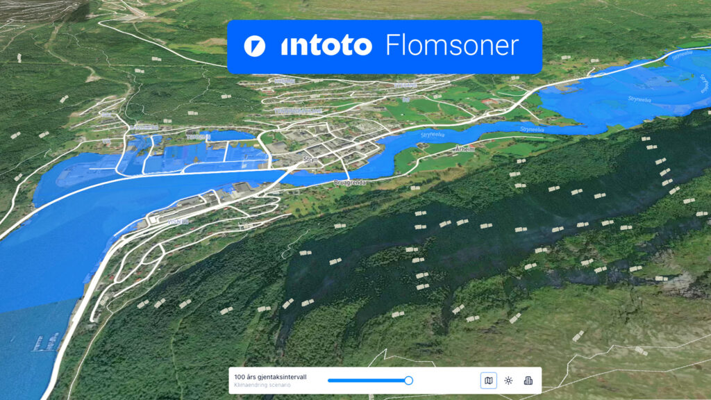
This user-friendly website lets anyone check historical flood data for any region in Norway. Just head to Flomsoner.no, locate your area of interest, and instantly access flood risk information.
But it doesn’t stop there. Flomsoner.no also gives a glimpse into the future by predicting which areas may experience rising sea levels or flooding in 20, 50, 100, and even 500 years.
The site is also the first to combine water levels in coastal areas and rivers, previously found in different silos.
How Does It Work?
The Intoto platform combines data from these data sources in the site:
- NVE (Norwegian Water Resources and Energy Directorate)
- Kartverket (Norwegian Mapping Authority)
These sources provide an extensive, research-backed look at Norway’s flood risk zones, making it easier for individuals, businesses, and municipalities to make informed decisions.
Why It Matters
Flooding is an increasing concern, especially with climate change contributing to rising sea levels and extreme weather events. Whether you’re a homeowner, business owner, a planner, or just curious, Flomsoner.no gives you the insights you need to understand and prepare for potential risks.
Try It Now
Flomsoner.no is live and available for everyone. Check it out, explore your region in Norway, and stay informed about flood risks for years to come.