
How Flekkefjord is using Intoto’s direct water-level data to gain earlier awareness at a known culvert flood point
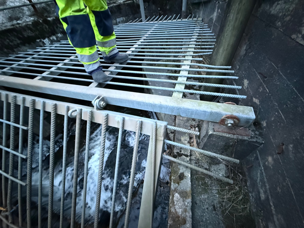
The problem: a culvert that struggles when it matters most
Many municipalities know exactly where their flooding problems start. A culvert that cannot carry the water. A stream inlet that backs up. A low point where the drain gives out first.
Flekkefjord has one of these places in a central area. In flood conditions, the culvert struggles to carry the water, and overflow can affect nearby shopping areas, parking areas and roads. As this area is close to sea level, high sea levels can make it worse by backing water up in the culvert.
The municipality knows where the problem is. What it has lacked is a reliable way to know how close that specific point is to overflowing, early enough to act.
Why rainfall data alone is not enough
A rain forecast or rain gauge tells you that it is raining. It does not tell you what the water is doing inside a constrained culvert, where the combination of stream inflow, culvert capacity and sea level decides what happens.
For the people responsible for the area, the operational question is narrower and more useful: What is the water level in the culvert right now, and how close is it to the grate?
The solution: measure the water where the risk is
Flekkefjord is working with Intoto.io to measure the water level directly in the culvert using a pressure sensor. Instead of inferring conditions from weather data, the municipality can get the actual water level at the flood-critical location.
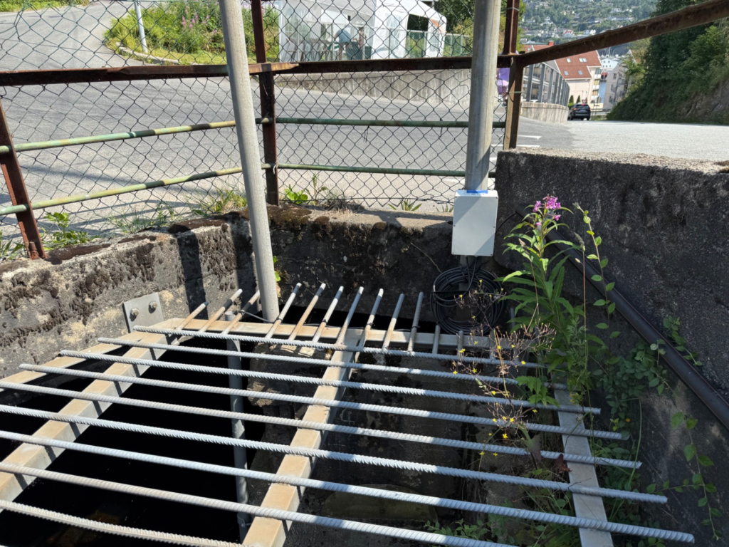
The approach follows a simple chain:
Physical condition → direct measurement → threshold → warning → human action
- Heavy rain or high inflow raises the water in the culvert.
- A pressure sensor measures the water level directly in the culvert.
- The measurement can be compared with a threshold defined for that location.
- When the threshold is reached, a warning can be sent.
- People can act according to the municipality’s own response plan, before water reaches the grate.
Every site is different, and thresholds are decided with the municipality, based on local knowledge.
Fitting into the systems the municipality already uses
Good data is only useful if it arrives where decisions are made. Flekkefjord wants the water-level data delivered into its existing SCADA monitoring system, Citect, for example through API integration. The goal is for operators to see the culvert level in the same environment they already use, with no extra dashboard to check during a developing situation.
Municipalities already use sensors across their technical systems. The difference with Intoto is not simply another sensor. It is reliable data from the locations that matter, delivered into the systems municipalities already use. Intoto can also handle the measurement infrastructure and data delivery as a service, so the municipality does not have to manage everything itself.
The value is in the data
Sensors are a starting point. What a municipality is really paying for is the quality of the data, a number it can trust at the moment it has to decide.
Intoto’s data is built around what matters for that decision:
- It is measured, not estimated. A pressure sensor reads the water level in the culvert itself, at the point where overflow can happen.
- It is specific. The data describes one vulnerable location, not a general area or a regional forecast.
- It is actionable. Data can be tied to a threshold the municipality chooses, so a reading can inform a decision rather than just become a graph.
- It is usable. When delivered through API integration into existing monitoring systems, it becomes part of the municipality’s normal operations.
Trust in the quality of the data is central to what Intoto provides. When the water level in a culvert is the number deciding whether crews are sent out, the data has to be right. Here, Intoto measures the water level directly rather than estimating it from rainfall data.
What this does and does not do
Intoto doesn’t stop water from rising. Culverts, streams and sea levels will rise. What Intoto provides is a measurement the municipality can rely on: the water level, read directly in the culvert, at the point where overflow can begin.
That reliability is what makes the data useful. With reliable data from this location, Flekkefjord municipality can decide what to do, when to do it, and who to send, according to its own response plan.
The decisions stay with the people who know the location best. Intoto’s role is to make sure they are working from data they can trust.
Does your municipality have a similar location?
The Flekkefjord scenario is common. Many municipalities have flood-critical locations they already know about:
- Culverts under roads, railways and built-up areas
- Stream inlets that back up under heavy inflow
- Low points that collect water first
- Drains and stormwater outlets affected by high sea level
- Underpasses, tunnels and grates where overflow tends to appear
If you know where the problem is but lack data from that exact spot, the same approach can apply: measure directly, define your threshold, and get the data into the systems you already use.
Do you have a specific flood-threat location that needs to be monitored? Contact us.